
Update: Applications for the CCST Science & Technology Policy Fellowship Have Closed
NASA Partners with Amazon to Put Climate “Big Data” Online
November 22, 2013 | CCST Newsroom, Federal Research in California | Contact: M. Daniel DeCillis
A large collection of NASA climate and Earth science satellite data are being made available through the Amazon Web Services (AWS) cloud in a novel partnership designed to enhance research and educational opportunities nationwide.
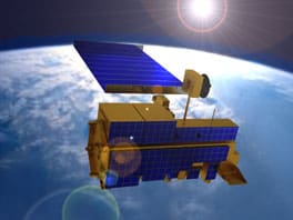
To date, several terabytes of data from three satellite and computer modeling datasets have been uploaded to the AWS platform: a set of high-resolution climate change projections from the NASA Earth Exchange (NEX) research program; a global view of Earth’s surface provided by the Moderate Resolution Imaging Spectroradiometer (MODIS) instrument on NASA’s Terra and Aqua satellites; and the Landsat data record from the U.S. Geological Survey, which provides the longest existing space-based record of Earth’s land. Ultimately, the service will include a wider variety of NASA satellite data sets, including metrics such as temperature, precipitation, and forest cover.
The service also includes data processing tools from the NEX program, based at the NASA Ames Research Center. (NASA Ames is a CCST Affiliate Institution.) NEX is a collaboration and analytical platform that combines state-of-the-art supercomputing, Earth system modeling, workflow management and NASA remote-sensing data. Through NEX, users can explore and analyze large Earth science data sets, run and share modeling algorithms, collaborate on new or existing projects and exchange workflows and results within and among other science communities.
“We are excited to grow an ecosystem of researchers and developers who can help us solve important environmental research problems,” said Rama Nemani, principal scientist for the NEX project at Ames, in a statement from NASA on the launch of the partnership. “Our goal is that people can easily gain access to and use a multitude of data analysis services quickly through AWS to add knowledge and open source tools for others’ benefit.”
As CCST has previously noted, increasing access to and use of “big data” – extremely large data sets – has rapidly become a key basis of competition, underpinning new waves of productivity, growth and innovation. NASA has always supported and provided open public access to research data, but the collaboration with AWS makes these data more accessible to a much wider audience, allowing the ability to access and process information without the need to directly download unwieldy amounts of data.
Increased access to, and the ability to analyze, data sets such as this are particularly important for states such as California, which are working to plan long-term strategies for more effective water system management – a planning process which depends greatly upon the most accurate understanding possible of climate trends and impacts on the state’s water resources.
An example of data similar to that available from the website. The animation shows the results of analyzing satellite radar data collected between mid-2007 and 2011 – about 3.5 years – in the southern San Joaquin Valley. Basically, the analysis technique subtracts 1) the time it takes a radar pulse to leave a satellite, reflect off the ground, and return to the satellite on, for example, July 1, 2007, from 2) a subsequently measured time of travel collected, for example, on December 30, 2111. If it takes longer for the radar signal to travel back to the satellite on the second pass (Dec. 2011), that means the distance between the satellite and the ground has increased. The increased distance is mostly due to land subsidence. The orbits of the satellite are known so precisely that the subsidence can be measured at sub centimeter levels, over great areas on the ground, at about 90 meters square pixel size. The technique is called InSAR (Interferometric Synthetic Aperture Radar). Video courtesy of JPL/NASA.


Our Mission
To engage leading experts in science and technology to advise State policymakers - ensuring that California policy is strengthened and informed by scientific knowledge, research, and innovation.