CCST Welcomes UC Santa Barbara’s Rachel Segalman, PhD, to Board of Directors
Mapping Salmon Habitat From Space: How a chance conversation grew into a partnership spanning two hemispheres
August 10, 2026 | CCST Newsroom, CCST S&T Policy Fellows
By Fernando Romero Galvan, CCST Science & Technology Policy Fellow, California Department of Water Resources.
California’s Central Valley was once a shifting mosaic of wetlands and floodplains, where rivers spread across the land each winter and drew back each summer. That rhythm fed young salmon and sustained a way of life for the Native American Tribes who have fished here since long before there was a California. Most of those floodplains are gone now, drained and cut off from the rivers that made them. Salmon have held on, and they remain a food source for Tribes and a livelihood for fishing families up and down the coast. Those families just went three straight years without a season due to low numbers.
The same rivers now run through the hub of California’s water system: the Sacramento–San Joaquin Delta, which, through its connection to major State and federal water projects, supplies drinking water to over 27 million people and irrigates about 3 million acres of farmland. Now, California is investing in rebuilding wetlands and floodplains, because they are needed for salmon, a fish that is culturally and ecologically irreplaceable, and because they are essential for a healthy water supply for humans, not to mention their function in reducing flood risk for Central Valley communities.
When I began my CCST Science & Technology Policy Fellowship at the California Department of Water Resources (DWR) this January [2026], my mentors, Dr. Louise Conrad and Pascale Goertler, handed me a question that sounded simple and turned out to be anything but.
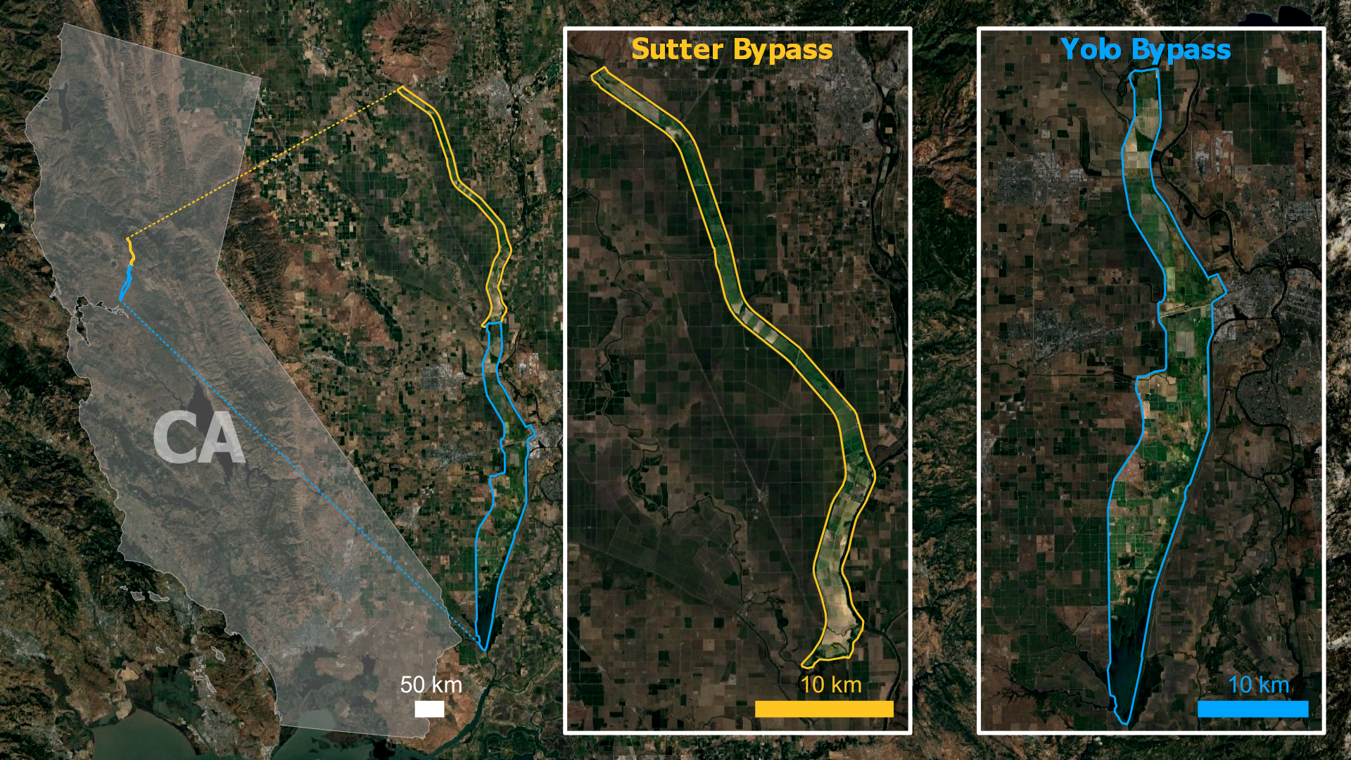
Through its Healthy Rivers and Landscapes (HRL) program, among other initiatives, California is restoring habitat in the Yolo and Sutter Bypasses. These are engineered floodplains built in historical flood basins, and their first job is flood control: when the Sacramento River runs high, the bypasses take the water that would otherwise reach Sacramento and the towns around it. But they can do two things at once. The same shallow, slow, seasonally flooded ground that protects cities turns out to be excellent rearing habitat, giving juvenile Chinook salmon room to feed and grow before they head out to sea. However, that comes with a question the program is required to answer:
As floodwaters recede, how does the quality of salmon habitat change?
This is not a new question at DWR. Two decades ago [2005], a team of DWR scientists spent three flood seasons in the Yolo Bypass and came back with reason for optimism. Young salmon reared on the floodplain for a month or more, left it larger than they arrived, and appeared to follow the receding water out rather than collect in isolated ponds. They also found where fish do get caught. In the concrete scour ponds below Fremont and Sacramento weirs, salmon densities averaged between 2,700 and 14,200 fish per hectare across the three study years, compared with about 190 to 530 per hectare in nearby earthen ponds. Later [2017], a DWR-led study drawing on twelve years of observation reinforced that picture, finding that juvenile salmon moved off the floodplain in greater numbers as floodwaters receded. Still, the original authors were careful about what a few flood seasons on a single floodplain could support, writing that they could not rule out different outcomes in other years or other places.
That is where our work picks up. The hypothesis I am testing is that expanding salmon’s access to these floodplains will not strand them at levels that matter to the population, and that we can monitor stranding potential across the Bypasses closely enough to show it. Getting to a population-scale answer means describing floodplain habitat across an entire flood season.
Two things make that hard. The first is sheer size and speed (Yolo Bypass alone is more than 59,000 acres!), water levels shift through winter and spring, and much of the ground is hardest to reach exactly when monitoring is most needed. The second is that the system itself keeps changing. HRL, along with projects like the recently completed Big Notch at Fremont Weir, is changing how often and how widely these floodplains flood, and the work is expanding into the Sutter Bypass, which has been studied far less than Yolo. Some projects modify a weir. Others create managed floodplains where people set the inundation schedule directly.
You cannot send someone to walk every drying pool every day. However, something does pass over these landscapes again and again: satellites. Early on, we decided that spaceborne Earth Observation (EO), such as those publicly available by NASA, would enable us to track conditions across areas far too large to survey on foot. EO instruments offered a natural way to approach a problem defined by water that appears and vanishes.
We were not starting from scratch on the remote sensing side either. We met with Dr. Erin Hestir at UC Merced and Dr. Shruti Khanna of the California Department of Fish and Wildlife, who had already built a method to detect isolated pools from Sentinel-2 imagery. Their work gave us a foundation. Around the same time, we began assembling a science advisory committee of salmon biologists and Delta experts, whose knowledge would keep the remote sensing grounded in how fish live and move.
Video: Drone footage of a Tule Red by DISE UAV Team, Anthony Elias-Linarez (DWR ES), Chaley Nye (DWR ES). Editing by Bailey MkNelly.
Then the project took a serendipitous turn.
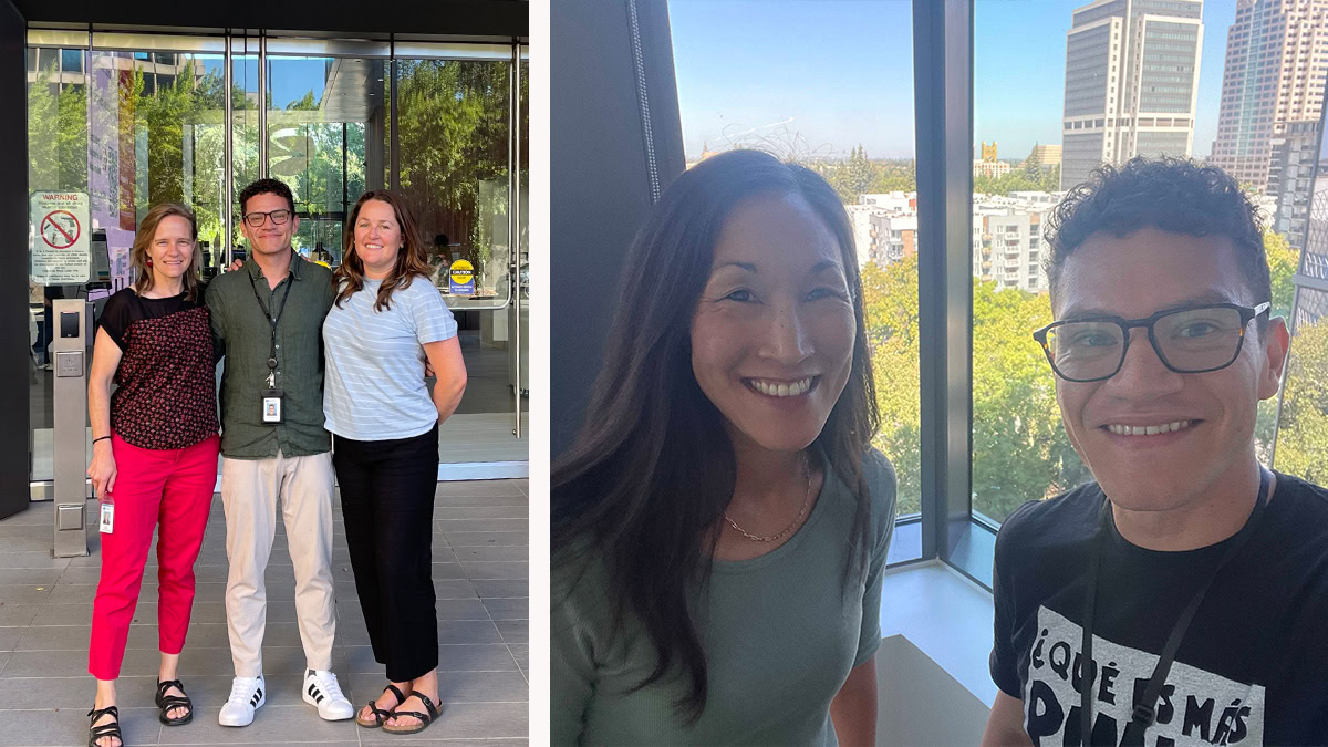
On March 20th CSIRO, Australia’s national science agency, reached out to DWR to explore collaborations – on the platform of a standing Memorandum of Understanding between the California Natural Resources Agency and the Australian government that commits to collaboration on shared management challenges. We presented our EO approach to predicting and monitoring potential salmon stranding, and to estimating how long a pool stays suitable for salmon once it is cut off. CSIRO was immediately interested. They run a program called AquaWatch, an effort to build something like a weather forecast for water quality, and our problem fits squarely within their mission. Dr. Alex Held, CSIRO’s Chief Scientist for Earth Observation and AquaWatch, was part of those conversations and championed the project from the start. On the spot, CSIRO’s Margaret Donoghue, who leads their work in the United States, brought us into a meeting already on their calendar at Caltech with NASA’s Jet Propulsion Laboratory (JPL) and representatives from NASA Headquarters.
That invitation meant more to me than I let on. I got my start in remote sensing as an intern at JPL, learning to read the surface of the Earth from its heat. The chance to sit across the table from JPL again, this time representing a California state agency, felt like a homecoming I never expected the fellowship to give me.
The meeting itself, on April 17th is one I will not forget. We presented our work to NASA- JPL and NASA-HQ, with Dr. Held there to back the collaboration, and we left with something better than applause. We left with encouragement to submit a statement of work and request funding from NASA to make the project real. So, within a matter of weeks, we worked with UC Merced, UC Santa Barbara, CSIRO, NASA-JPL, and DWR to request additional funds and carry the project for another year.
Over the following months, the funding came together: a commitment from NASA Headquarters, cloud-computing credits from CSIRO, NASA funds supporting part of UC Merced’s contribution, and money DWR put up itself. The work, which extends well past the end of my fellowship on October 31st , will carry forward into a postdoctoral position, where I will continue leading it from the Photon Informed Ecology Lab at UC Santa Barbara with Dr. Zoe Pierrat.
From here, the goal is to build an AquaWatch-style platform tailored to DWR, train DWR and other CNRA staff to work with EO data directly and develop workshops so that remote sensing has a real chance to prove its usefulness inside a state agency. That last part matters to me as much as science does.
Powerful satellite data already exists. It only helps California if the people making decisions can reach for it, and one of the clearest things this fellowship has shown me is how often they cannot.
That gap is not a DWR problem or even a California one. As Lee and colleagues argue, the United States’ science and technology space assets go underused largely because too few people are trained to work with what they produce, and geoscience degrees are not being conferred fast enough to close the distance. Building the satellite product is the easier half. Building the capacity to use it is the half that decides whether any of this matters.
Looking back, what strikes me most is how little of this followed a straight line. I was presented with a question about salmon. Now, I find myself at the center of a partnership that connects a California water agency to a national lab, an international science organization, and two UC campuses. Almost none of it was planned. It would be easy to call that luck. Louise, my mentor here, has taught me to look underneath that word. Along with the career, science, and life advice she offers freely, she has a way of showing me the longer view that luck tends to go where people have been investing. CNRA and UC Merced had been cultivating these relationships for years before I got here, and DWR had been asking questions about floodplain habitat for two decades.
What this project did was give a standing commitment to partnership something concrete to take shape around. My part was mostly to be ready when it did, to translate between a biologist’s question and a satellite’s capabilities, keep the right people in the same conversation, and say yes when an unexpected opening appeared.
But I was only one node in a network of people who made this real. Margaret Donoghue at CSIRO drove the conversation with NASA forward and helped us get the statement of work across the line. Dr. Shruti Khanna at CDFW and Dr. Erin Hestir at UC Merced gave us both the methods and the steady support to build on them. Dr. Zoe Pierrat has taken me on as her mentee and will guide the next chapter of this work. Dr. Louise Conrad, Pascale Goertler, and Lindsay Correa at DWR mentored me in the truest sense, introducing me to every member of our science committee, keeping resources flowing my way, and championing me until the funding for this postdoc came through.
That is what the CCST Fellowship gave me. More than a project, the room and the standing to build something that outlasts the fellowship itself. And it all grew from one hypothesis in the Healthy Rivers and Landscapes science program, proof that a well- posed question can travel a remarkably long way. I came to DWR curious about how science finds its way into the decisions a state makes. I am leaving with a working example, still unfolding, of exactly that.
About the CCST Science & Technology Policy Fellowship
The CCST Science & Technology Policy Fellows program places PhD-level scientists, engineers, and social scientists in the California State Legislature, State Agencies, and Offices of the Governor for a year of public policy, leadership training, and public service—training scientific thinkers to be policy-savvy, while helping equip California’s decision makers with science-savvy staff. Discover how CCST S&T Policy Fellows make a difference in California’s policy arena and learn how to apply at CCST.us/CCST-Science-Fellows-Program.