
Program Associate
Mashalle Olomi
Staff
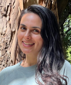
Mashalle Olomi
Mashalle Olomi is a Program Associate with CCST’s Science Services team. She brings experience spanning Earth observation research, university and nonprofit program management, and teaching. She is particularly interested in using multimodal remote sensing to inform decisions about agricultural landscapes.
Before joining CCST, Mashalle served as a Graduate Science Research Mentor for NASA’s Student Airborne Research Program, where she guided research projects that used aerial and satellite data to study flooding, erosion, urban heat, and water quality. During the DEVELOP program at NASA JPL, she led a project that combined multispectral imagery, UAV lidar, SAR, and machine learning to map biomass and carbon in Midwestern agroforestry systems. She has also taught courses on sustainable agriculture at UC Davis.
Earlier in her career, Mashalle coordinated programs at UC Berkeley’s Center for Middle Eastern Studies, enforced policy as a Trust & Safety Associate at YouTube, and managed county grants and programs serving refugee families in Sacramento.
Mashalle earned an MS in International Agricultural Development from UC Davis, specializing in remote sensing and plant science. Her master’s thesis evaluated the impact of whole orchard recycling and almond biochar compost on young almond trees using remote sensing and field measurements. She also holds a BA from UC Berkeley.